Current Research in the Uttal Lab
Training Spatial Skills: What Works, for Whom, and for How Long?
David H. Uttal, Nathaniel G. Meadow, Linda L. Hand, Alison R. Lewis, Christopher Warren, Nora Newcombe, and Ksjusha Povod
- Having good spatial skills strongly predicts achievement and attainment in STEM fields (e.g., Shea, Lubinski, & Benbow, 2001; Wai, Lubinski, & Benbow, 2009). Improving spatial skills is therefore of both theoretical and practical importance. To determine whether and to what extent training can improve these skills, we meta-analyzed 217 research studies, investigating the magnitude, moderators, durability and generalizability of training on spatial skills. After eliminating outliers, the average effect size (Hedges’ g) for training relative to control was .47 (SE = .04). Effect sizes were affected substantially by the presence and type of control groups. When treatment and control group improvements were considered separately, the mean effect size for trained groups was .62 (SE = .04), significantly larger than the effect size for control groups, .45 (SE = .04). Training effects were stable and were not affected by delays between training and post-testing. Training also led to both near and moderately far transfer. Considered together, the results suggest that spatially enriched education could pay substantial dividends in increasing participation in mathematics, science, and engineering.
Spatial Ability and the Use of Mapping Software: A two-way street
Maria Ptouchkina, Kjusha Povod, David H. Uttal-
Spatial thinking involves the representation and transformation of the locations of objects and figures. In the present work, we investigated the relation between the use of Geographic Information Software (GIS), spatial thinking, and spatial ability. Geographical Information System, GIS, is a powerful tool for representing multiple layers of spatial information as overlapping maps. The present study investigated the relations between GIS learning and children’s spatial ability by analyzing performance on spatial-related skills tests. It also examines the role of spontaneous gesture in spatial cognition and communication.
Pointing Out the Role of Maps and Gestures in Spatial Development
Megan Sauter, Ellen Reynolds, David H. Uttal, Susan Goldin-Meadow, and
-
Using maps influences how we think about space (Uttal & Wellman, 1989; Liben, 1999; Uttal, 2000) by allowing us to see, and to think about, spatial relations that would be difficult to acquire from direct experience. Maps can also influence the way we communicate spatial information. Here we investigated the influence of using a map on the development of spatial thinking and spatial communication. We asked children to communicate locations that they had learned from a map or from navigation alone. Interestingly, the influence of maps first appears in the gestures of children when communicating space and not in their speech. We suggest that this finding may reflect that maps and gesture share similarities in terms of communicating spatial relations in a visual, integrated manner.
Maps in a Snap: Can comparison facilitate preschoolers’ understanding of maps?
Lei Yuan, Megan Sauter, David H. Uttal, Dedre Gentner
- Young children often have difficulty identifying the correspondences between elements on a map or model and the same elements in the space (Deloache, Uttal, & Pierroutsakos 1989). In the current study, we examine whether comparison can facilitate children’s understanding of map-space correspondence. Comparison is a powerful learning mechanism that highlights relational commonalities (Gentner, 2003). Preschoolers are shown a model and a map of a neighborhood. In the comparison condition, the experimenter explicitly highlights the commonalities among the relations between the map and model. In the control condition, the experimenter describes the elements in the map and the model but does not highlight the commonalities between the two. Our results show that the children who learn through comparison show an improved understanding of map-space correspondence following this training.
Countering Diagrammatic Narratives: The effect of animation on the interpretation of evolution
Camillia Matuk and David H. Uttal
- Many students' prior intuitive understanding of evolution is of a journey of one species through various states of transformation through increasingly sophisticated and complex forms. In accord with this folk theory, students tend to incorrectly interpret the cladogram - a diagram of species phylogenetic relationships - as a chronology of events. In individual clinical interviews with 73 undergraduate students, we explore the relationship between symbolic meaning and diagrammatic structure in the interpretative process. In Study 1, we illustrate how elements of students' narrative understandings, including a clear beginning, and determinate end; a sequence of events; and a plot with characters acting toward a goal, are easily mapped onto the structure of the diagram. In Study 2, we use animation to impose a presentation sequence upon the cladogram that counters this typical folk narrative interpretation. Our findings suggest that intuitive spatial metaphors can be reversed, and visual structure and spatial location flexibly interpreted. Notably, we found that the effect of Good Continuation and the appeal of the folk theory of evolution remain powerful organizers of perception.
Inventing an Intuitive Representation of Relatedness
Camillia Matuk and David H. Uttal
- Students have difficulty reading cladograms – diagrams of evolutionary relationships among species. Their systematic errors suggest a problematic interaction between diagrammatic structure and existing misconceptions of evolution. In this study, we ask: Is there a more intuitive representation of the concept relatedness? In individual clinical interviews across two studies, we gave 33 undergraduate students hypothetical data sets, and asked them to invent representations to show relative relationships among items. Students later viewed a standard cladogram solution to the same task, and were asked to reason about the relationships shown. Study 1 suggests that actively constructing a personally meaningful representational system primes students to later perceive functional aspects of the conventional diagram, and detracts them from their otherwise intuitive narrative interpretations. Study 2 shows an effect of content assumptions on the kinds of diagrams invented, and on students' strategies for subsequently reasoning with the standard diagram. Where most research into learning from scientific representations tends to focus on the various ways in which students misunderstand them, this project highlights the important role of students' prior conceptual knowledge, and of the representational resources they bring to the task - each of which shapes interpretations of unfamiliar diagrams, and is necessary to acknowledge when designing effective instructional supports and interventions.
How Sketches Reflect Spatial and Causal Scientific Knowledge
Benjamin Jee, David H. Uttal, Dedre Gentner, Kenneth Forbus, Bradley Sageman, Nadeeka Dias
- Geoscience requires learning about complex causal processes that occur over large ranges of space and time. How do geoscientists represent their knowledge of geologic processes? We examined this question using two distinct methods. Participants with differing levels of geoscience experience were presented with a series of geoscience-related and unrelated diagrams, and asked to (a) provide written descriptions of the diagrams, and (b) sketch the diagrams using the CogSketch software (Forbus et al., 2008). CogSketch records both the spatial-relational structure of the sketches and the process through which sketches were constructed, affording an examination of the convergence and uniqueness of participants’ written descriptions and their sketches. If geoscience experience leads to the development of causal mental models for geological processes, then more experienced students’ descriptions and sketches should reflect the diagrams’ causal sequence. We discuss our results with respect to CogSketch as a general measure of causal knowledge.
The Role of Alignment in Perceptual Learning of a Geoscience Concept
Benjamin Jee, David H. Uttal, Dedre Gentner, Brad Sageman, Cathy Manduca, Nadeeka Dias
- Geoscience education involves learning to identify geological structures in real-world images. This learning may be facilitated by viewing similar but contrasting schematic images, where one image contains the structure and the other does not (Jee et al., 2010). Highly similar items are easier to align structurally, thereby highlighting their common relational structure and any alignable differences (readily comparable but differing features; e.g., Gentner et al., 2007). The present research explored the basis of this learning benefit, and whether learning can be further enhanced by viewing realistic, contrasting images in addition to schematic, contrasting images. The focus of the study was the geological structure of a fault -- a fracture in rock along which there has been displacement. Participants read a brief instructional text about faults that included either (1) a single block diagram of a fault, (2) a pair of similar, contrasting block diagrams, one with a fault an one with a fracture, or (3) a pair of similar, contrasting block diagrams and a pair of contrasting realistic diagrams. Following the instructions, the participants completed a fault identification task, in which they saw a series of photos. On each trial the participant had to respond whether each photo contained a fault, and, if so, where the fault was located. Participants who saw only a single block diagram performed poorly, due mainly to their relatively high mean rate of false alarms. This suggests that viewing a pair of contrasting diagrams served to clarify the important distinction between the appearance of faults and fractures. Also, participants who saw both the block diagrams and realistic diagrams tended to perform the best. This suggests that viewing realistic images supported learning of features that were relevant to fault identification but are not present in schematic diagrams.
Past Research Conducted in the Uttal Lab -- top of page
Helping Hands: Gesture and Spatial Learning
Bonnie Vu, Priya Rajakumar, Melissa Sifuentes, Linda L. Hand, David H. Uttal
- Studies have shown that gesture can help us communicate information. However, gesture may also help us learn. In this study, we examine the role of gesture in spatial learning and recall. The results indicate that gesture is, in fact, linked to how people think about spaces. We show that people spontaneously gesture when reading a description of a spatial environment. Gesturing also helps improve recall of spatial environments. Those who gesture while thinking about a space through a route perspective tend to remember novel spaces more accurately. We also discovered that encouraging someone to gesture leads to better spatial memory; however, verbally discouraging them to gesture also leads to improvements in spatial memory. Lastly, the type of gesture we use matters. “Points” and “places” are two types of gestures that appear to be helpful for spatial memory. In these ways, gesture appears to play a significant role in how we process spatial information.
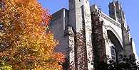
Learning Fine-Grained and Category Information in Navigable Real-World Space
David H. Uttal, Alinda Friedman, Linda Liu Hand, and Christopher Warren
- Spatial judgments are affected both by fine-grained and categorical knowledge. We investigated whether, and how, the two forms of knowledge are learned in real-world, navigable space as well as the time course of learning each type of knowledge. Participants were Northwestern University undergraduates who estimated the locations of buildings and other landmarks on campus. The Northwestern campus is roughly divided into three regions whose borders are not easy to discern either from a map or by navigation. Nevertheless, students often refer to these regions linguistically and use them when making housing decisions, choosing classes, etc. We found that knowledge of both the fine-grained configuration of locations and the regional distinctions increased with time. However, regional influences on judgments occurred later in students’ time on campus. Consequently, computed distances across the nonexistent border between north and south campus locations became more biased with time. The results have implications for understanding how spatial representations develop in navigable environments.